Mapping
Our mapping department specializes in the production of many different types of maps. We use the most up-to-date CAD, GIS, and graphics software to provide our clients with detailed, legible, and attractive maps for planning, presentation, personal, or marketing purposes.
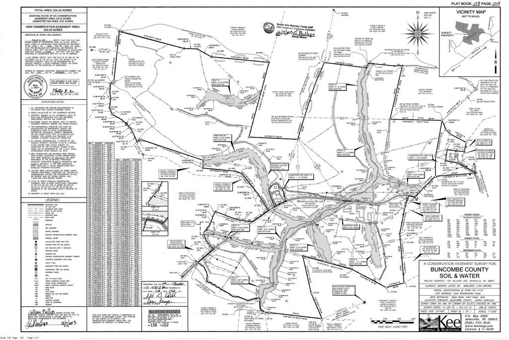
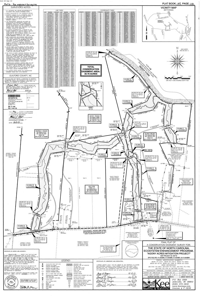
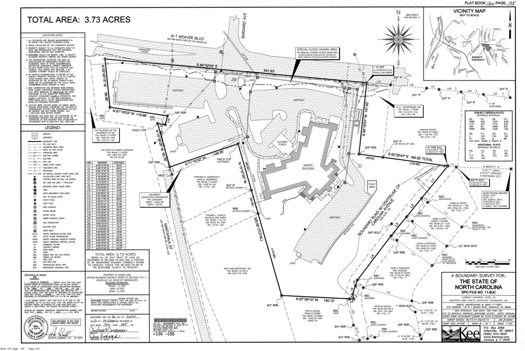
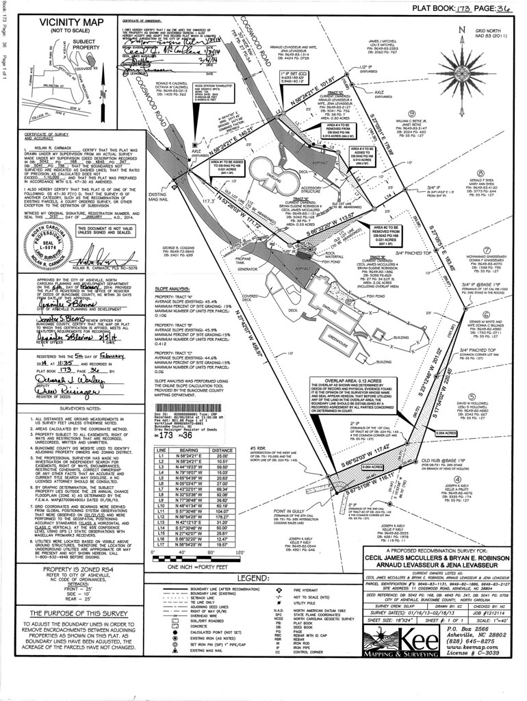
Standard PlatsThese maps range from boundary surveys to conservation easements and are drawn to meet state, county, and municipal requirements for recordation purposes. |
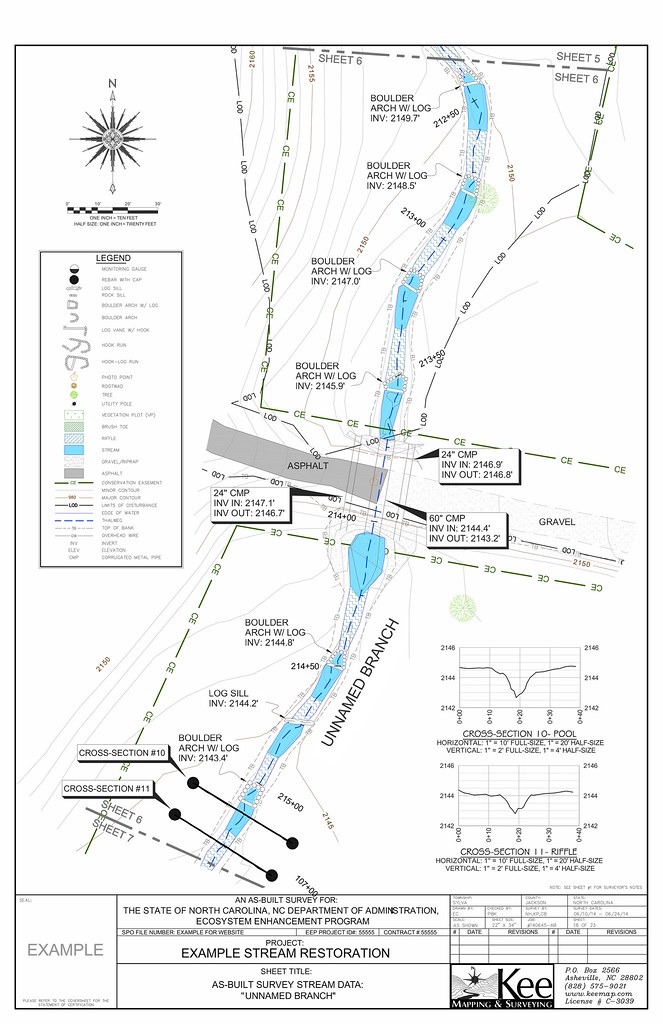
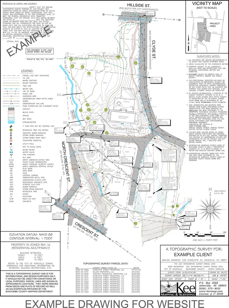
Digital MapsWe often send digital copies of our maps to clients who request them. These are typically in a CAD compatible format and are usually of our topographic, site plan or as-built surveys. |
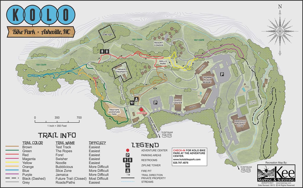
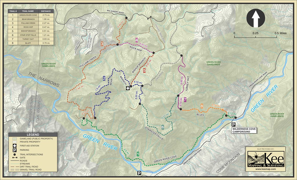
Trail MapsRanging from bike parks to extreme trail races we produce accurate depictions of important information the user requires such as mileage, difficulty, routes, resupplies, etc. |
Aerial MapsWhether it’s for planning or presentations, we create high resolution aerial maps that designers and engineers need for various stages of their projects. |
Conceptual MapsOverlaying designs and drawing files with aerial imagery and other GIS data will produce a product that can aid the designer or engineer in their planning process and will also help them determine the environmental impact of their plans. |
GIS ServicesOur GIS specialists can aid the client with many of their GIS needs such as: Geodatabase development & management, shape file creation, aerial imagery, etc.
|